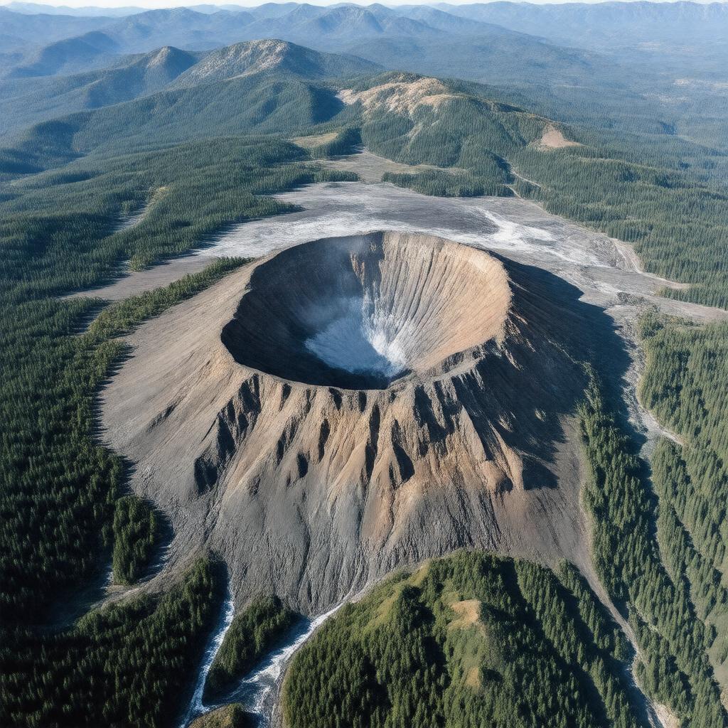
Statements (297)
Predicate | Object |
---|---|
gptkbp:instance_of |
gptkb:volcano
|
gptkbp:affects |
local climate
surrounding ecosystems |
gptkbp:affiliated_with |
gptkb:United_States_Geological_Survey
|
gptkbp:area |
gptkb:Mount_St._Helens_National_Volcanic_Monument
1,500 square miles |
gptkbp:ash_cloud |
released during eruptions
|
gptkbp:ash_deposits |
widespread in surrounding areas
|
gptkbp:ashfall_area |
across several states
|
gptkbp:ashfall_impact |
affected agriculture in nearby areas
|
gptkbp:associated_with |
gptkb:Geologist
gptkb:Mount_St._Helens_National_Volcanic_Monument gptkb:emergency_services gptkb:local_government gptkb:scientific_community |
gptkbp:casualties |
57 deaths
57 people killed in 1980 eruption |
gptkbp:caused_by |
lahars
ashfall |
gptkbp:climate |
gptkb:tropical_rainforest
marine west coast climate |
gptkbp:climate_impact |
affected local weather patterns
local weather patterns affected |
gptkbp:colors |
80,000 feet
across several states 80,000 feet during 1980 eruption |
gptkbp:community |
focused on eruption prediction
|
gptkbp:coordinates |
122.1944° W
46.1912° N |
gptkbp:created_by |
subduction of the Juan de Fuca Plate
|
gptkbp:cultural_heritage |
recognized by local communities
|
gptkbp:cultural_impact |
inspiration for literature
inspiration for art inspiration for film |
gptkbp:cultural_significance |
inspired art and literature
important to local Native American tribes to local tribes |
gptkbp:defeated |
lahars
landslides ashfall |
gptkbp:designated_as |
gptkb:National_Volcanic_Monument
|
gptkbp:discovery |
discovered by European settlers in 1805
discovered by European settlers in the 18th century |
gptkbp:ecosystem |
yes
diverse flora and fauna post-eruption recovery |
gptkbp:educational_programs |
available for visitors
developed for visitors |
gptkbp:elevation |
2,550 meters
8,366 feet 8,366 feet (2,550 meters) |
gptkbp:emergency_exits |
established for safety
|
gptkbp:emergency_services |
in place
one of the most studied in history 1980 eruption caused significant loss of life |
gptkbp:environmental_impact |
deforestation
soil degradation long-term changes air quality deterioration devastated surrounding forest devastated surrounding ecosystems |
gptkbp:famous_for |
1980 eruption
|
gptkbp:first_ascent |
1857
|
gptkbp:flora |
wildflowers
|
gptkbp:geological_features |
gptkb:caldera
gptkb:volcano stratovolcano geological research andesite andesitic lava volcanic dome lava dome approximately 40,000 years approximately 40,000 years old caldera formed after eruption |
gptkbp:geological_formation |
yes
conducted by various universities important for understanding volcanic processes |
gptkbp:geological_monitoring |
active
critical for understanding eruptions |
gptkbp:has_education |
programs available
|
gptkbp:has_historical_significance |
gptkb:Native_American_culture
Native American history |
gptkbp:has_impact_on |
gptkb:tourism
geology local ecology ecosystem recovery wildlife recovery |
gptkbp:has_lava_dome |
gptkb:Lava_Dome_1980
|
gptkbp:has_national_volcanic_monument |
gptkb:Mount_St._Helens_National_Volcanic_Monument
|
gptkbp:has_observation_points |
yes
observation decks |
gptkbp:has_research_areas |
volcanology research
|
gptkbp:has_research_center |
gptkb:Mount_St._Helens_Observatory
gptkb:Mount_St._Helens_Institute yes USGS monitoring stations volcanic research centers |
gptkbp:has_visitor_center |
gptkb:Mount_St._Helens_Visitor_Center
yes |
gptkbp:highest_point |
gptkb:Mount_Adams
|
gptkbp:historical_event |
1980 eruption was a major geological event
|
gptkbp:historical_records |
yes
|
gptkbp:historical_significance |
impact on local communities
study of volcanic eruptions major geological event influence on disaster preparedness important for volcanic research |
https://www.w3.org/2000/01/rdf-schema#label |
Mount St. Helens
|
gptkbp:impact |
devastation of surrounding area
|
gptkbp:influences |
local climate
|
gptkbp:is_a |
gptkb:tourist_attraction
gptkb:agricultural_land gptkb:protected_area gptkb:cultural_landmark active volcano scientific research site symbol of volcanic activity geological hazard natural disaster site environmental study site |
gptkbp:is_a_subject_of |
gptkb:documentaries
|
gptkbp:is_associated_with |
gptkb:scientific_research
local history |
gptkbp:is_considered |
active volcano
a symbol of volcanic activity in the U. S. |
gptkbp:is_documented_in |
gptkb:literature
geological surveys |
gptkbp:is_featured_in |
gptkb:books
gptkb:documentaries gptkb:films |
gptkbp:is_home_to |
diverse wildlife
unique ecosystems various bird species endangered species |
gptkbp:is_influenced_by |
climate change
|
gptkbp:is_influential_in |
volcanic studies
|
gptkbp:is_known_for |
landslides
scientific expeditions geological hazards ashfall ash deposits catastrophic eruptions landslide events |
gptkbp:is_located_near |
gptkb:Columbia_River
gptkb:Spirit_Lake |
gptkbp:is_monitored_by |
gptkb:Geologist
gptkb:USGS gptkb:United_States_Geological_Survey_(USGS) ongoing since 1980 installed for eruption prediction |
gptkbp:is_observed_in |
gptkb:Johnson_Ridge_Observatory
|
gptkbp:is_part_of |
gptkb:Gifford_Pinchot_National_Forest
gptkb:Mount_St._Helens_National_Volcanic_Monument gptkb:Pacific_Ring_of_Fire gptkb:U._S._National_Park_System gptkb:Mount_St._Helens_National_Park environmental studies geological research projects Mount St. Helens volcanic field |
gptkbp:is_popular_for |
gptkb:photography
hiking camping educational tours wildlife viewing |
gptkbp:is_protected_by |
gptkb:historical_landmark
|
gptkbp:is_recognized_by |
gptkb:UNESCO
|
gptkbp:is_recognized_for |
gptkb:volcanic_activity
natural beauty |
gptkbp:is_studied_for |
gptkb:volcano
geological formations geological processes ecological recovery |
gptkbp:is_studied_in |
gptkb:scientists
geologists |
gptkbp:is_used_for |
gptkb:education
|
gptkbp:is_visible_from |
gptkb:Portland
surrounding highways |
gptkbp:is_visited_by |
tourists
|
gptkbp:known_for |
1980 eruption
|
gptkbp:lahar |
triggered by eruptions
volcanic mudflow |
gptkbp:lahar_flow |
gptkb:North_Fork_Toutle_River
|
gptkbp:land_use |
recreational and educational purposes
recreational activities allowed managed by the U. S. Forest Service managed by U. S. Forest Service efforts ongoing since eruptions |
gptkbp:landforms |
gptkb:mountain
|
gptkbp:landmark |
prominent feature in the Pacific Northwest.
|
gptkbp:landscape |
significant alteration after eruptions
|
gptkbp:landslide |
triggered by 1980 eruption
triggered by eruption 1980 eruption caused a massive landslide |
gptkbp:last_eruption |
gptkb:1980
gptkb:2008 gptkb:5 gptkb:Cascade_Range gptkb:bombs gptkb:1800s 9 hours active yes high monitored regularly ongoing 2008-2009 1980-05-18 reforestation efforts tourism increase monitoring programs approximately 40,000 years ago multiple eruptions Plinian plinian 1980 eruption May 18, 1980 lahars and ashfall potential for future eruptions plinian eruption emitted during eruptions increased prior to eruptions critical for public safety remains a subject of interest. significant geological event influenced local ecosystems monitored by USGS approximately every 100-300 years |
gptkbp:lava_dome |
formed after 1980 eruption
|
gptkbp:lava_dome_formation |
1980-1986
|
gptkbp:located_in |
gptkb:Washington
|
gptkbp:location |
gptkb:Washington,_USA
|
gptkbp:managed_by |
gptkb:U._S._Forest_Service
|
gptkbp:named_after |
gptkb:George_Vancouver
gptkb:William_St._Helens gptkb:Horace_St._Helens |
gptkbp:national_volcanic_monument |
established in 1982
|
gptkbp:nearest_city |
gptkb:Castle_Rock
|
gptkbp:notable_event |
1980 eruption
|
gptkbp:part_of |
gptkb:Cascade_Range
|
gptkbp:prominence |
1,303 feet
1,163 meters |
gptkbp:public_access |
accessible to visitors
|
gptkbp:public_awareness |
increased after 1980 eruption
|
gptkbp:range |
gptkb:Cascade_Range
|
gptkbp:research |
gptkb:ecology
geology ongoing volcanology volcanology studies extensively studied by volcanologists important for studying volcanic eruptions |
gptkbp:research_focus |
volcanology
|
gptkbp:research_importance |
volcanology
key site for volcanology research |
gptkbp:research_institutes |
gptkb:local_universities
|
gptkbp:scenic_views |
gptkb:volcano
surrounding mountains valleys |
gptkbp:significant_event |
1980 eruption
1980-1983 eruptions 2004-2008 eruptions May 18, 1980 eruption 1980 eruption caused major destruction |
gptkbp:team |
ongoing
ongoing restoration projects |
gptkbp:tourist_attraction |
gptkb:hiking_trails
gptkb:visitor_center yes scenic viewpoints popular hiking destination |
gptkbp:trails |
yes
|
gptkbp:type |
stratovolcano
|
gptkbp:vegetation_recovery |
ongoing since 1980
ongoing after 1980 eruption |
gptkbp:visitors |
gptkb:hiking_trails
yes high over 1 million annually |
gptkbp:visitors_per_year |
over 1 million
|
gptkbp:was_affecting |
surrounding communities
|
gptkbp:wildlife |
gptkb:deer
gptkb:elk eagles black bears coyotes home to various species mountain goats surrounding area observed post-eruption |
gptkbp:bfsParent |
gptkb:The_Cascade_Range
gptkb:Mount_St._Helens_Eruption gptkb:Mount_Hood gptkb:Washington gptkb:Cascade_Range gptkb:Ring_of_Fire |
gptkbp:bfsLayer |
4
|